Media release ·
One Jump Inc. and Droneworks Australia Partner to Deliver Business Intelligence from Drone Data Across Australia
From Drone Data to Business Intelligence: an integrated Australian offering combining professional aerial data acquisition, AI powered analytics, and actionable reporting for infrastructure, construction, property, and environmental management.
SYDNEY, AUSTRALIA, 31 October 2026 — US based technology company One Jump Inc. and Australian commercial drone services provider Droneworks Australia have entered into a strategic partnership to accelerate the adoption of artificial intelligence powered drone intelligence solutions across Australia’s infrastructure, construction, property, industrial, and environmental sectors.
The partnership combines Droneworks Australia’s experience in professional drone operations since 2018, CASA-compliant mission planning, infrastructure inspections, roof assessments, aerial mapping, and specialist sensor data capture with One Jump’s artificial intelligence, computer vision, machine learning, geospatial analytics, and interactive 3D modelling. Droneworks also contributes on-site knowledge, inspection objectives, and data quality planning, making it an integral partner in developing the solution rather than simply supplying aircraft and pilots. Both organisations will work together to scope projects, capture fit for purpose data, interpret the results, and deliver practical intelligence to clients.
From drone data to business intelligence, the combined offering connects safe, professional field data acquisition with analytical displays, measurements, visualisations, and evidence based reporting. Clients can use these outputs to understand assets, verify quantities, monitor changing conditions, identify risks, and prioritise operational, maintenance, and investment decisions.
The collaboration builds upon Australian drone intelligence demonstrations featured on One Jump’s technology platform, highlighting practical applications in construction, industrial site management, and environmental monitoring.
From Drone Data to Business Intelligence
A drone survey is the starting point, not the final deliverable. Droneworks Australia brings the local operational expertise to plan and conduct professional aerial inspections and capture data suited to the client’s objectives. One Jump applies AI, computer vision, and geospatial analytics to turn the collected information into business intelligence. Together, the companies provide a coordinated pathway from survey planning and data acquisition to analysis, visualisation, and decision ready reporting.
Depending on the project, deliverables can include interactive 3D models, geospatial maps, asset inventories, volumetric measurements, surface classifications, analytical dashboards, and evidence linked reports. Where appropriate sensors and survey methods are used, the offering can also support multispectral imagery, vegetation indices, infrared analysis, and individual spectral band displays. These capabilities extend well beyond conventional RGB drone photography and enable more targeted investigation of site and environmental conditions.
For clients, the value is practical: fewer disconnected handoffs between field capture and analysis, more useful outputs from appropriately planned surveys, clearer evidence for condition and quantity assessments, and repeatable information for maintenance, risk, and capital planning. Survey scope, sensor selection, and analytical deliverables will be agreed for each engagement.
Australian Demonstrations Highlight Practical Applications
Construction and Industrial Intelligence
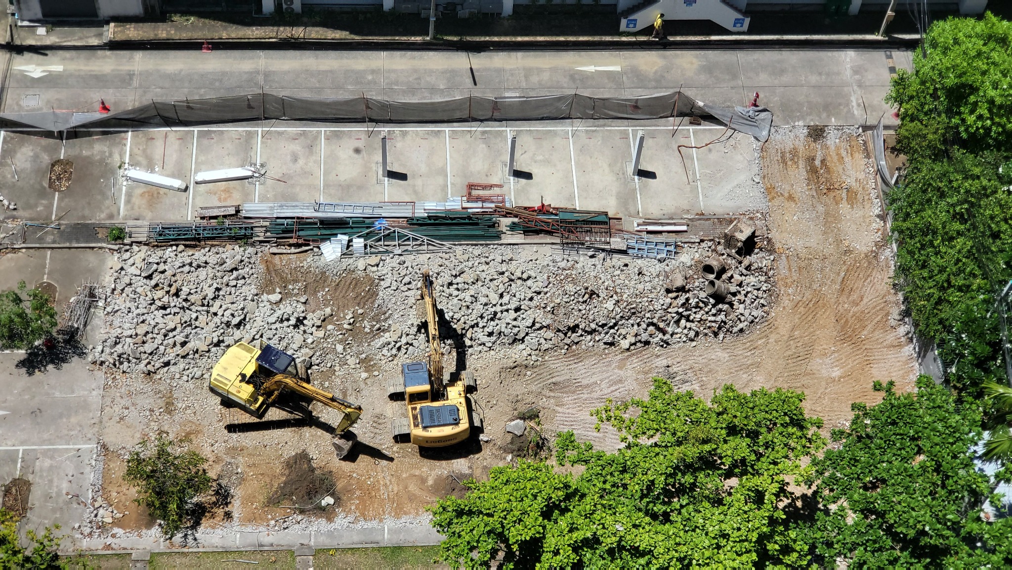
One Jump has demonstrated how a single drone survey can be transformed into detailed operational intelligence for construction and industrial environments. In one Australian demonstration, 856 drone photographs captured across approximately 12.6 hectares were processed into an interactive 3D model and supporting analytical outputs. The analysis included measurements of 14 material stockpiles, equipment inventories, surface classifications, material quantities, and operational risk indicators.
Together, Droneworks and One Jump can apply these capabilities to construction progress reviews, stockpile and material quantity verification, industrial site inspections, asset inventories, and operational planning. Droneworks provides the field capture and site context; One Jump produces the corresponding measurements, interactive models, and analytical outputs for client review.
Environmental and Sustainability Intelligence
One Jump has also demonstrated the application of multispectral drone imagery to environmental monitoring in Australia. Its platform includes seven analytical displays, including vegetation indices, infrared imagery, and individual spectral bands. The resulting information supports assessment of vegetation cover, canopy condition, and areas potentially experiencing environmental stress.
For environmental and sustainability applications, Droneworks can undertake appropriately specified aerial surveys while One Jump processes the resulting datasets into analytical displays and interpretable evidence. Depending on sensor availability and project scope, deliverables may include multispectral imagery, vegetation indices, infrared analysis, and spectral band visualisations to support baseline assessments, vegetation management, restoration monitoring, and identification of potential environmental change. These outputs complement, rather than replace, specialist ground assessment.
Additional Published Use Cases and Client Deliverables
Residential Roof and Property Intelligence
One Jump’s published residential roof demonstration explicitly identifies a Droneworks partner flight. The 93 waypoint mission captured 447 photographs across 43 roofs and generated measurements covering 4,770 square metres of roof area. The outputs include roof area, pitch and planes, eave and ridge heights, gutter lengths, roof objects, tree overhang, access flags, and flight log quality checks. The example shows how professionally captured aerial data can support repeatable, property level inspection records rather than photography alone.
Infrastructure, Industrial and Precinct Intelligence
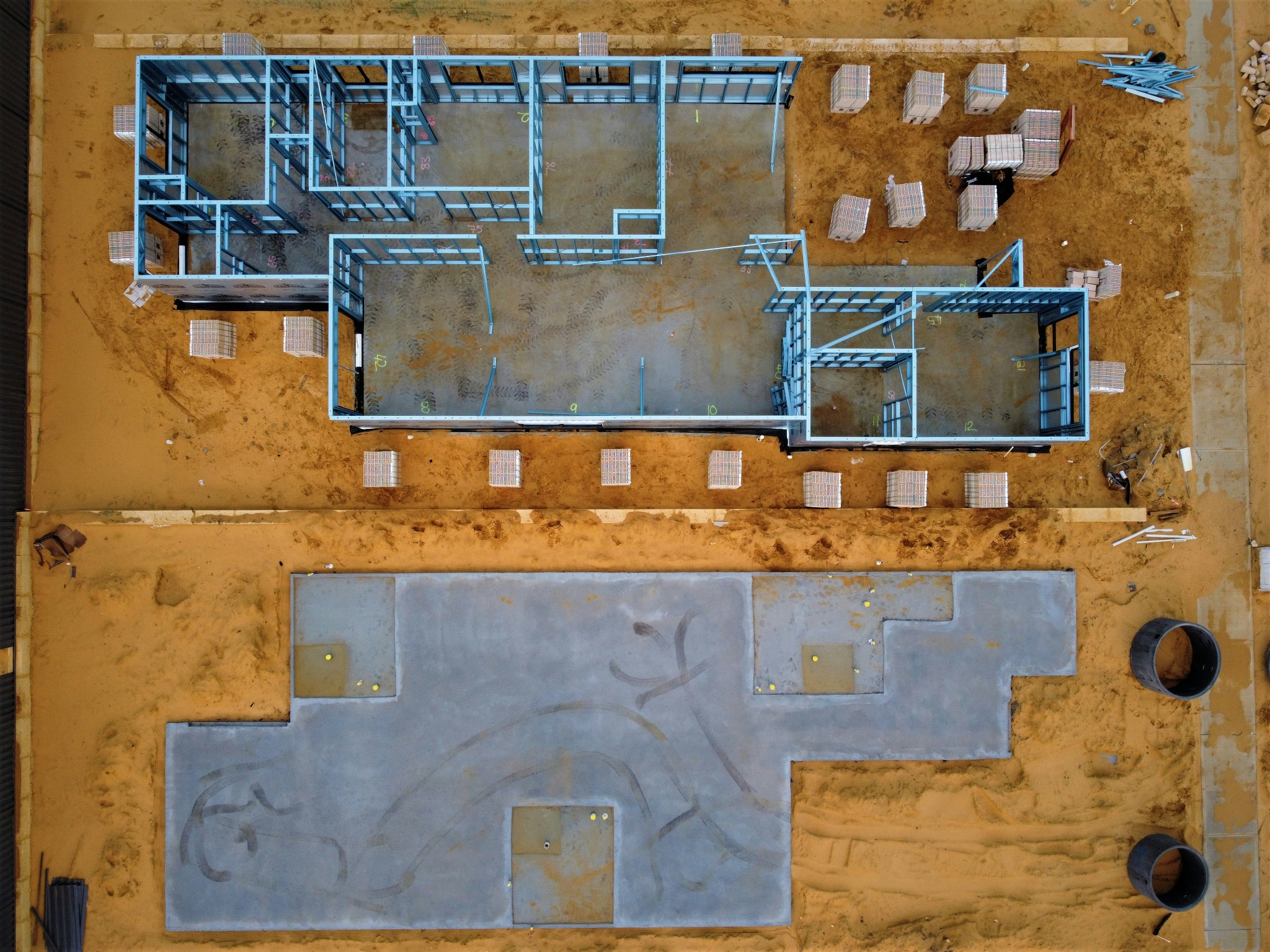
Published demonstrations also show how aerial datasets can support construction stockpile volume and tonnage estimates, plant registers, material classification, excavation and sheet piling progress, and surface or runoff risk observations. Other examples include commercial precinct building footprints, heights, roof areas, parking counts, and land use characteristics. One Jump additionally presents a targeted infrastructure inspection pilot workflow for waterfronts, warehouses, and transport hubs. These applications illustrate opportunities for asset owners, councils, insurers, developers, and industrial operators to commission decision ready outputs.
Environmental and Vegetation Intelligence
The published estuarine wetland example presents seven analytical displays from multispectral data, including NDVI canopy vigour, NDRE chlorophyll stress, and mapped mangrove, saltmarsh, mud, and open water cover. Other demonstrations cover individual tree height, crown and canopy volume, vegetation health and missing tree identification. Such analyses require the appropriate sensors, data quality, site conditions, and agreed project scope; they are not automatic outputs of every conventional RGB flight.
For prospective clients, the partnership offers a coordinated route from identifying a business question and planning suitable data acquisition through to analytical visualisations, measurements, evidence linked findings, and reporting. Droneworks contributes inspection planning, site and airspace risk assessment, appropriate sensor selection, and professional data capture; One Jump contributes analytical technology and interpretation. Potential deliverables include condition records, roof measurements, construction progress comparisons, 3D models, asset inventories, volumetric reports, multispectral vegetation maps, and thermal findings, according to project requirements and sensor availability. The combined approach can help clients reduce repeat site visits, assess hard to access assets more safely, prioritise maintenance, and support better documented decisions. Published demonstrations illustrate technical capability and should not be read as claims that every use case has already been delivered commercially by the partnership.
Leadership Perspectives
Karandeep Chadha, Australia Lead, One Jump Inc., said the collaboration addresses a longstanding challenge in how organisations collect, interpret and utilise information about physical assets.
“Australia manages an enormous and geographically dispersed portfolio of infrastructure, buildings, industrial facilities and environmental assets. Yet many organisations continue to rely on periodic physical inspections, fragmented datasets and reactive approaches to maintenance and risk management. This partnership is about closing the gap between data collection and decision making. By combining professional drone operations with artificial intelligence, computer vision, geospatial analysis and interactive 3D models, we can help organisations better understand asset condition, quantify risks, monitor changes and prioritise interventions. What particularly excites me is that we are not starting with a theoretical proposition. We already have tangible Australian examples across construction, industrial operations and environmental monitoring that demonstrate the potential of this technology. The next opportunity is to translate these capabilities into scalable, commercially relevant solutions for governments, infrastructure operators, developers, asset managers and industry. Ultimately, the value is not in how much data we collect, but in how effectively that data improves decisions, reduces risk and delivers better outcomes.”
Paul Gonsior, Chief Remote Pilot, Droneworks Australia, highlighted Droneworks’ integral role in designing and delivering a complete intelligence solution, from field planning and safe data acquisition to practical client outcomes.
“Droneworks is more than a drone operator in this partnership. We bring the aviation expertise, field knowledge and survey planning needed to collect the right information for each client’s problem. One Jump brings the analytical technology to turn that information into measurable findings and clear visual outputs. Together, we can offer clients a coordinated service, from aerial capture through to 3D models, asset measurements, analytical displays and reporting. With the appropriate sensors, that can also include multispectral imagery, vegetation indices and infrared analysis, extending the value well beyond standard aerial photography. Our aim is to give clients information they can actually use to manage sites, assess risks and plan their next actions.”
Supporting Australia’s Infrastructure and Digital Transformation Priorities
Australia’s infrastructure investment requirements, urban development, energy transition, and increasingly complex asset portfolios are creating demand for more efficient and scalable approaches to managing physical assets. Drone enabled intelligence can complement traditional surveying and inspection methods, particularly where assets are geographically dispersed, difficult to access, or exposed to changing environmental and operational conditions.
The combined service is relevant to infrastructure and asset management, construction and development, property and facilities management, environmental monitoring, and transport, logistics and industrial operations. Potential client deliverables include condition records, volumetric measurements, material inventories, interactive site models, building inspection evidence, vegetation analysis, infrared and multispectral analytical displays, comparative reports showing change over time, subject to project scope and capture technology.
A particular focus will be on repeatable surveys that allow organisations to compare asset conditions over time, identify emerging issues and integrate drone derived information into asset management systems, geographic information systems, and digital twin environments. The companies will also investigate automated defect identification, predictive analytics, volumetric monitoring, and artificial intelligence assisted reporting.
Building a Scalable US and Australia Technology Collaboration
The partnership reflects the potential for international technology companies and Australian specialist operators to collaborate in delivering advanced digital capabilities to local markets. One Jump brings technology development, artificial intelligence, and analytics, while Droneworks Australia contributes local drone operations, aviation compliance expertise, and practical experience working across Australian environments.
Droneworks Australia and One Jump intend to provide a single coordinated pathway from project scoping and professional aerial data capture through to processing, analysis, visualisation, and reporting. Droneworks contributes local operations, aviation compliance, and site knowledge; One Jump contributes AI driven interpretation and analytical products. Together, they aim to help clients move beyond buying drone photographs to commissioning decision ready business intelligence, with deliverables matched to real operational and investment questions.
About One Jump Inc.
One Jump Inc. is a US based technology company developing artificial intelligence, machine learning, and data driven solutions for commercial and industrial applications. Its drone intelligence capabilities transform aerial imagery into interactive 3D models, measurable asset inventories, geospatial information, and evidence linked analytical insights. Its published demonstrations cover construction, environmental monitoring, agriculture, building inspections, and property intelligence.
One Jump website · Explore drone intelligence demonstrations
About Droneworks Australia
Droneworks Australia is a Sydney-based Australian commercial drone services provider operating professionally in the drone sector since 2018. Its published services span infrastructure and roof inspections, construction and site monitoring, mapping and surveying, aerial imaging, thermal inspections and multispectral analysis for vegetation, land-use, and environmental applications. Droneworks describes CASA-compliant, insured operations and lists Remote Pilot, Remote Operator, aeronautical radio, and beyond visual line of sight credentials. Its operational approach includes defining inspection objectives, assessing airspace and site risks, planning repeatable surveys, and capturing fit for purpose datasets in complex construction, industrial, and urban environments. Alongside One Jump, Droneworks contributes more than aircraft operations: it helps design the inspection workflow and obtain the reliable visual, spatial, and sensor information needed to generate actionable business intelligence.
Media Enquiries
Karandeep Chadha
Australia Lead, One Jump Inc.
[email protected]
onejumpinc.com
Paul Gonsior
Chief Remote Pilot, Droneworks Australia
[email protected]
droneworks.au